Monday to Tuesday, June 29 – 30, 2015 —
An early departure from Positano to continue south was the plan. The run to Scario on the mainland is about 70 nautical miles and we wanted to allow time to swing through Amalfi just to see it. There was not time to waste. Amalfi was as adorable as Positano was cute. 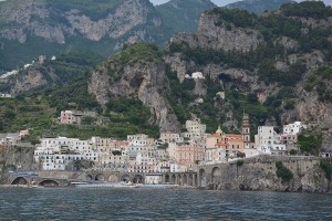 Also, it appeared from the water, to have less crowds—a big plus. There were a few incredible looking hotel/resorts hanging over the cliffs. We commented to each other that this area deserves another visit, possibly with more time and the addition of a rental car to visit some of these incredible places not accessible by boat. We just can’t get over how incredibly beautiful this coast is!
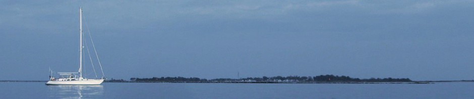
We arrived in Scario with less than an hour of daylight to get settled. The anchorage area did not look like much from the charts but it was listed in the Imray Cruising Guide so we felt confident arriving close to dark. Unfortunately, our optimism let us down. When we arrived, the anchorage area shown on the chart having ideal depths and good holding had been taken over by a mooring field. When we tried to drop anchor outside the mooring field we found the holding to be questionable. At that point an individual from the small community came all the way out on the breakwater to gesture something. With the distance between us, the wind, and the language barrier, we had no idea what he was trying to tell us. Judging by his animated hand signals, however, we determined that it was not OK to anchor there. We picked up the anchor and moved 100 yards to the west, to an area of equally questionable holding ground. The man ashore no longer seemed concerned. Since it had now gotten dark and the forecast was for dead calm that night we dumped a pile of chain on the bottom and set the anchor alarm committing to each other to sleep lightly.
Scario Anchorage: 40° 02.95’ N by 015° 29.56’ E: Poor holding and open to the south and east
The next morning a slight wind came up and, sure enough, we dragged—time to move on. We motor sailed further south to another small town by the name of Cetraro that indicated an anchorage area on the chart. We noticed that as we went further south the coastline gradually transitioned from rock cliffs that dropped straight into the sea, to rolling hills filled with lush green vegetation gradually tapering into the sea.  Here the coast line met the sea in a way that would suggest wide sandy beaches and great shallow anchoring. This time we were rewarded with a large shallow bay with a nice sandy bottom in the lee of a natural land spit and breakwater. There was not much to the town along the water, although we did not venture to the hillside town that looked more interesting. The marina behind the breakwater appeared to have been built to attract the cruiser business but doesn’t seem to have panned out that way. We were going to anchor for just a few hours of rest before leaving around 1800 hours for a nighttime run to the Aeolian Islands to see Strombolie’s light show. But, then we discovered the free WIFI access the local marina provided was a strong signal, reliable and lightning fast. We decided to stay for the night! We fired up our two computers and looked like junkies catching up on all the news we had missed over the past week.
Cetraro Anchorage: 39° 31.56’ N by 015° 55.41’ E: Excellent holding in sand, 5 to 10 meters, protected on three sides, exposure to south swell.